Ella Rock Hike: Easy Makulella to Ella Route on Pekoe Trail Stage 15

The Hike to Ella Rock is one of the most difficult in Sri Lanka. We ditched the sweat for a nice walk in the forest. This is our guide to the easy way to Hike Ella Rock from Makulella on the scenic hike Pekoe Trail Stage 15.
We had to make it to the top of Ella Rock! After all, we were on our third visit to Sri Lanka, and the top of the mountain in Ella village is a rite of passage for any backpacker. But we didn’t follow the crowds; instead, we took the Makulella to Ella route, part of the Pekoe Trail Stage 15.
This is the Ella Rock easy hike nobody tells you about (unless you’ve spent mornings covered in leeches and mud, like us).
Here’s our warts-and-all, caffeine and coconut-fueled, downright honest tale of what it’s really like to hike Ella Rock, Sri Lanka—straight from our muddy boots and grinning faces.


👋Toti & Ale here
London couple, 45+ countries, 300+ guides. We travel full-time content creators, travelling as slowmads around the world. Currently in Southeast Asia, after a 3+ months spell in Sri Lanka. This guide is all about Ella Rock Hike, and based on our first-hand experience. We have been in Sri Lanka 3 times in the past 3 years – our last trip was deeper into the culture for 3 months.
March 26, 2026 Refreshed with routes updated, flooding, official notes and prices for the entrance, transport and food. No AI; all road-tested.
Why Hike Ella Rock? And Why This Route?
There’s the “typical” Ella rock hike slog. But we wanted a more scenic and, less thronged adventure, skipping the uphill grind that everyone seems to complain about. We rely on an official Pekoe Trail Guide – Chamila.
Enter: the Makulella to Ella Rock route. The Makulella to Ella Rock route is the Ella Rock alternative trail, part of the Pekoe Trail project. Specifically, we learn that this is a network of 22 stage hikes swirling through Sri Lanka’s tea country. It covers approximately 300-323 km (186-200 miles) throughout central Sri Lanka.
This part of the trail, stage 15, is beginner-friendly and offers breathtaking views that rival the official hard hike. However, it also tosses in a few curveballs (leeches being one… and surprise monks in the mist). So, armed with curiosity and too little bug spray, we went for it.
This post includes affiliate links. We may earn a small commission at no cost to you. You can also buy us a coffee to support the site directly. Learn more in our Cookie Policy.
Makulella Route vs. Traditional Ella Town Route
| Aspect | Makulella Route | Ella Town Route |
|---|---|---|
| Distance | 9.6 km | 6.5 km |
| Elevation Gain | Lower ascent, tougher descent | Steep ascent |
| Crowd Levels | Much fewer hikers | Very crowded |
| Scenery | Tea estates, eucalyptus forests, rail track as last | Village and railway tracks first |
| Difficulty | Moderate | Hard |
Tips & Practical Info for Your Ella Rock Hike
Best time: Dry season (December to March), early mornings are perfect to avoid clouds and catch breathtaking sunrises.
What to pack: At least 2 litres of water, sunscreen, insect repellent, sturdy shoes with grip, and a rain jacket if it’s the wet season.
Safety: Descending the traditional path is the trickiest part; take your time and watch your footing.
Wildlife: Expect leeches in the wet season; watch for vibrant birds and occasional monkeys in the eucalyptus zone.
Navigation: Follow orange dots marking Pekoe Trail; signposts at major forks. The route is well signed, but stay alert in fog.

How we got there: our planning
I swear we prepared for this hike, compared to others, easier (like the Pidurangala rock hike, which we just showed up twice!). There’s something about the Ella fog that just begs for coffee. Like when we were in Sapa, Vietnam.
We dragged ourselves out of bed at a time that felt illegal — 6AM. We were still tired from our unique experience in the unreachable Knuckles Forest Reserve. Our early start was strategic: either to avoid crowds or because the weather isn’t great after midday in the shoulder season.
Our driver dropped us at Makulella (Here), cutting miles of uphill suffering. Starting from Makulella, you’re almost cheating—the steepest part of Ella Rock is behind you before the legs even warm up.
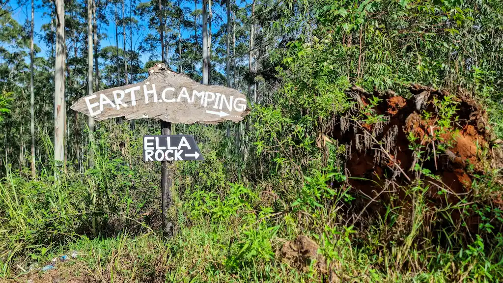
The entrance is obvious, with Pekoe Trail signs, right where rural life still hums along: dogs, farmers, the odd tuk-tuk hauling old tea baskets and a monk (yes, really). We didn’t see any tourists around until we reached the Ella rock entrance, just FYI.


Makulella to Ella Rock (Pekoe Trail Stage 15) MAP
The route covers roughly 9.6 kilometres and typically takes around 3 hours at a comfortable pace. Stage 15 of the Pekoe Trail runs from Makulella through eucalyptus and pine forests, climbing gently before hitting the Ella rock summit. The difficult steep section comes on the way down towards Ella town.
This trail is marked by bright orange dots painted on trees — Pekoe’s signature markers — but do keep your wits about you as some sections wind through narrow, rocky terrain. You’ll pass by a peaceful Buddhist temple, old tea plantations, and spot tiny local homes perched on the hillsides.
What looks like hiking Ella Rock from Makulella point
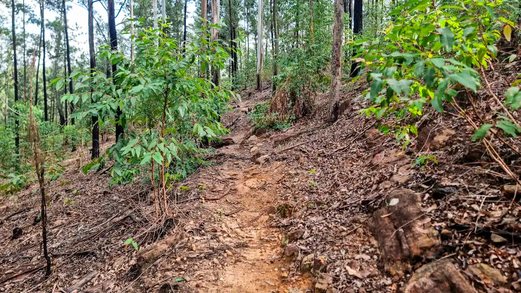
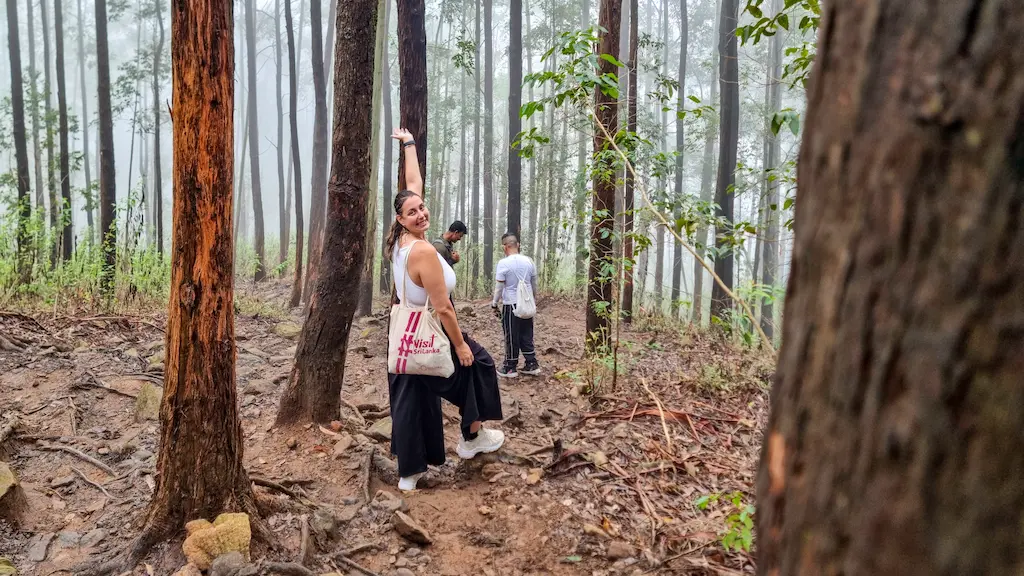
Let’s get honest: the Makulella to Ella Rock route is pure scenery. The first hour is forested, a clay-packed path that’s only a shade slippery (if it rained the night before, double your caution and grip with every step). Minerals glint in the dirt—our guide called them “lucky stones.” The real luck was not twisting an ankle gawking at them.
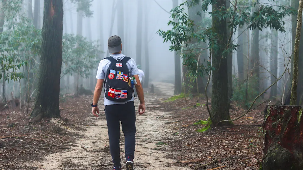
If you’re tracking the Ella Rock trail map, you’re heading straight for the eucalyptus pines, with a jungle soundtrack included: monks chanting, a distant crow, and our own heavy breathing.
We were 1,131 meters above sea level – The top point of Ella rock is 1,376 meters (4,514 feet). The signs (orange arrows) were surprisingly clear. Within minutes, we peeled left toward Ella Rock.
Here’s where the “easy” Ella Rock beginner hike reputation hits a snag: the trail narrows and mud takes over, especially after rain. Ale’s shoe choice (white, tragic) attracted the first leech.
Never, ever underestimate these little vampires during the wet season—they will find you. Don’t panic, just flick them off before they become attached. Literally and emotionally.
Through Forests, Pines & Monk Monasteries
The eucalyptus forest felt almost Australian, except for the heartbeat of Sri Lankan mountain life. Slopes drop off beside you, and sometimes you see burnt ground—locals light controlled-ish fires for new grass, which is bad for the terrain and smoke pollution. A big problem here in Sri Lanka.
Suddenly, we found ourselves in an old, outgrown tea plantation. Seems nobody cares about it, the bushes are taller than expected. We hit the monastery—a mystical spot shrouded in morning mist.
This isn’t a tourist trap: turn off your phone, whispers only. Signs are clear. The monks keep it peaceful, and there’s a feeling you should keep your Instagramming to after you pass through.
Ella Rock Peak: We found Mist and no view
After the monastery, things ramp up. You’re only about 120 meters below the summit, and it’s a gentle, if muddy, incline through more pine and the odd burnt patch. We absolutely lucked out—we got a passing tuk-tuk, engine straining, delivering food to the monks.
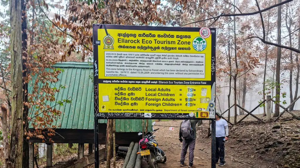
The last stretch gets mystical: fog rolls in, covering everything in ghostly clouds. We reached the first “Ella Rock Eco Tourism Zone” sign, ignored the outdated fee notice, and pushed on as drizzle began.
Just before the summit, the official fee station appears. Tickets for foreigners are 930 LKR each (2025 Update)—officially, they fund trail maintenance. (Don’t forget: bring enough cash, there is no card reader and no mercy.)
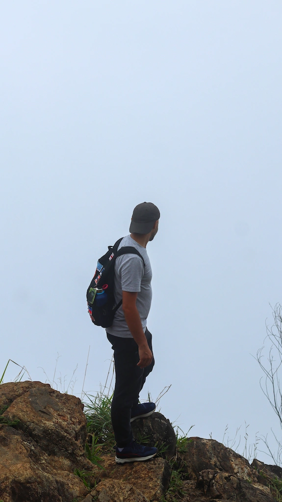
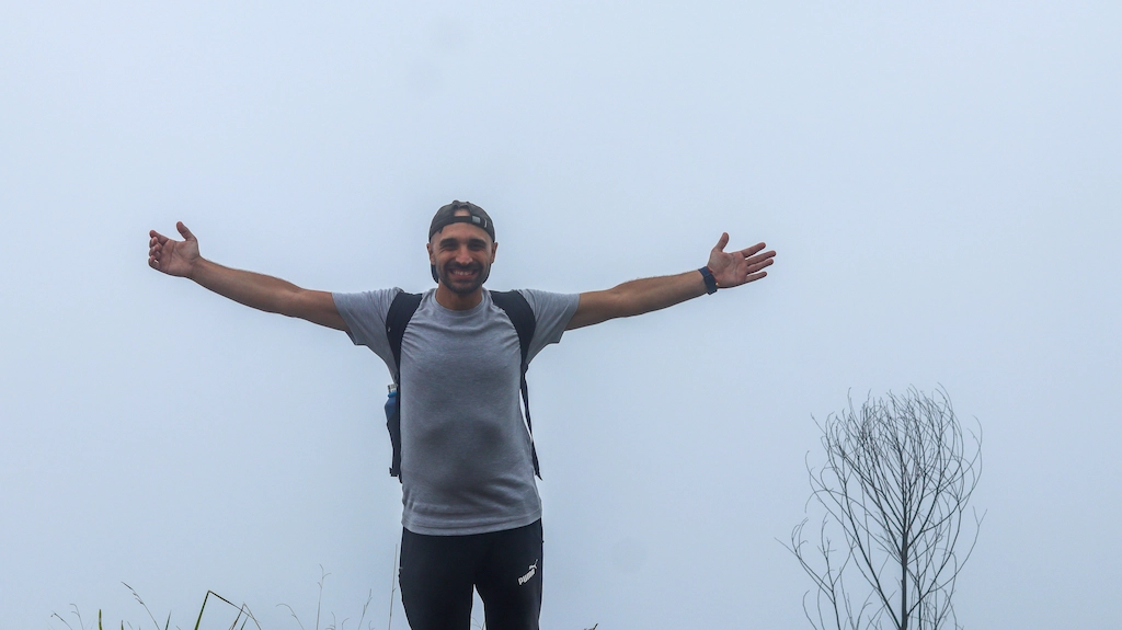
We sheltered under a rickety roof as a quick storm passed. The view… Well, let’s talk expectations vs. reality. Some days, Ella Rock is all cloud and mood. Small breaks in the fog gave us moving glimpses of the valley, waterfalls, and Ella town way below.
Is it worth it? Absolutely, if not for the view, then for the sense of achievement and the photos of clouds racing past jagged pines. If we have a chance to go back to Ella, we will do it again for a better view.

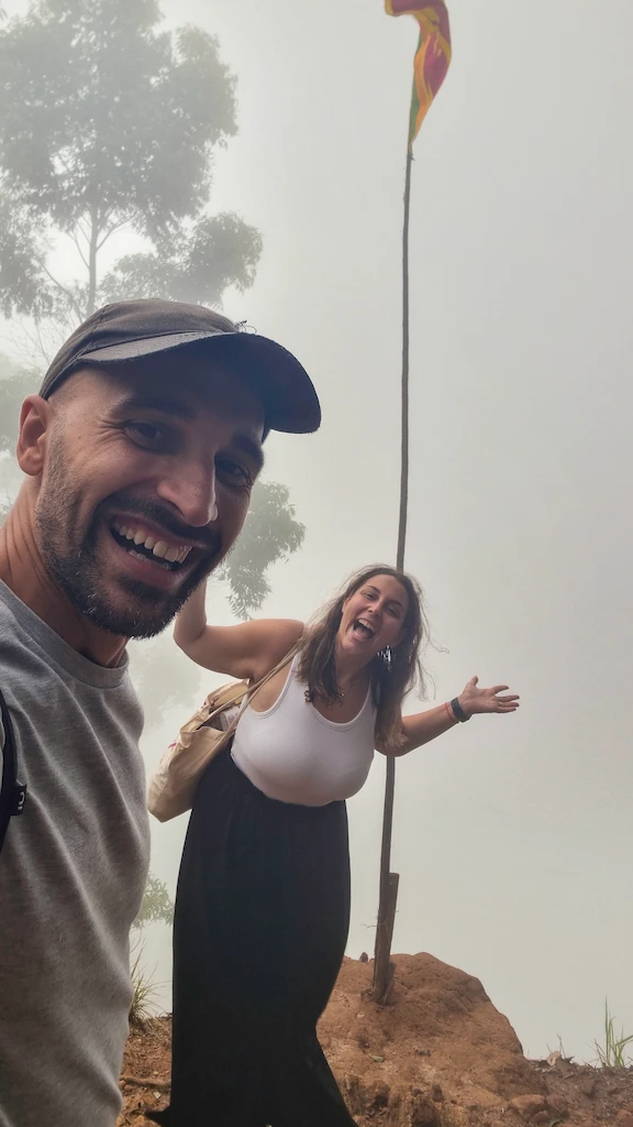
Mood was still high, despite the missing view
Our peak achievement might not be yours, hope for you for a better view. However, even in the mist, we really enjoyed the Ella rock hike. Don’t expect a summit café. There’s only a weathered sign, some boulders, and local dogs making big puppy eyes.
Our picnics were humble, just snacks and the stubborn hope that the clouds would part. A local mum-dog (clearly feeding her puppies but painfully skinny) made us split our food. Carry some extra food for her, please.
To be fair, that summit moment was surreal, sitting on warm rocks, shrouded in mist. We were disappointed that the Ella rock scenic route didn’t grant a full panorama. We felt like the clouds were a treat, with Ella Gap and Little Adam’s Peak playing peekaboo. It isn’t always instagrammable, but the middle of the pine forest is a vivid memory for us, and surely beautiful photos, too.

Downhill to Ella Town: Steep, Slippery, and Real
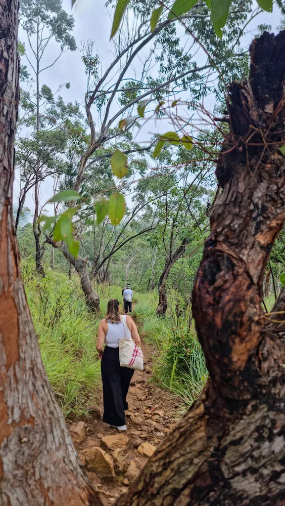
Everyone says the Makulella to Ella descent is “easy.” Here’s the tea: that depends on the rain and your knees. From the top, the trail turns into a rocky, rooty mudslide if wet.
On the way down, we lost vertical hard and fast—about 300 meters in less than an hour. The only thing steeper was Ale’s frustration when another leech found her ankle. Note to self and to you: high socks and long trousers if you’re hiking Ella Rock in the wet season, shorts and luck in the dry.
You’ll find vendors on the way down—it started with a coconut seller in the fog (trust us, Ale can sniff out coconuts from miles away). A plastic chair rests stop with another Sri Lankan flag snapping in the wind.
Coconuts cost 400 LKR (hiked up for tourists, but you’ll pay happily after sweating buckets). Don’t expect many more facilities before you hit the lower tea fields.
Our guides about Sri Lanka
IS ELLA WORTH VISITING?
THINGS TO DO IN JAFFNA

KANDY TO ELLA BLUE TRAIN

Tea Fields, Trains, and the Final Push
Approaching Ella, the Pekoe Trail markers switch from orange arrows to circular stamps. Tea fields sprawl out, some neat, some wild, pickers hauling baskets on their backs.
The landscape shifts: from misty up top, to almost tropical down low, with bright red earth and train whistles echoing. We crossed a little bridge and—suddenly—civilisation again: cafes, tea houses, the random goat vendor perched on a chair like a boss.
That final walk along the path into Ella town felt, honestly, victorious. We looked like wild animals ourselves, caked in mud and smiling. A cold drink and hot fried carbs have never tasted better.
You’ll pass on the train track
The final stretch of our trail is the classic one, where the original trail turns back and continues through Kithalella Railway Station. Still, it will lead you to Ella town instead. If you follow our suggestion and take the easy route from Makulella to Ella, the Ella Rock trailhead pin on Google Maps is your endpoint.
From there just the train track is an hour walk. We passed through some small cafes and rested with a nice cup of tea while watching the train rush by.
The walk on the train track and the high steel bridge passage is incredible. Arriving at the W1 Ella Resort (exact location here), take the paved road to Ella town.
This road will lead you to Gaia Ella Ecolodge (This place), which is the end of your Ella Rock hike trail. It was actually behind our accommodation in Ella – Ekho Ella (Fantastic, in theme with the town).
If hungry after the hike, there is a good local restaurant we love to recommend – Sleek Spoon Restaurant Ella.

Step-by-Step Hiking Instructions
- Start in Makulella
- Follow signs to the forest Monsatery
- Pass outgrown state tea plantations
- Arrive to Ella Rock summit
- Descend to Ella Town

1. Getting to Makulella
The trail starts just outside Makulella village. Take a tuk-tuk from Ella town (about 1,500 LKR using PickMe – however, PickMe doesn’t work in Ella as there is a big “mafia” with TukTuk drivers so try to negotiate a price!)
Bus options are limited, so a tuk-tuk or a private car works best. Parking near the trailhead is basic — mostly dirt spots — so don’t expect any facilities here. We suggest you don’t bring your own scooter unless you want to ride back on the trail from Makulella.

2. Trail Start and Early Terrain
The first kilometre is a flat dirt path lined with tall eucalyptus trees. Here, you’ll hear distant chants from a nearby Buddhist temple tucked in the forest. The air smells fresh, piney, and there’s a calm that contrasts starkly with the busier town below.
Shortly, you’ll pass the Forest Monastery, where silence is golden.
3. Crossing Through Tea Plantations
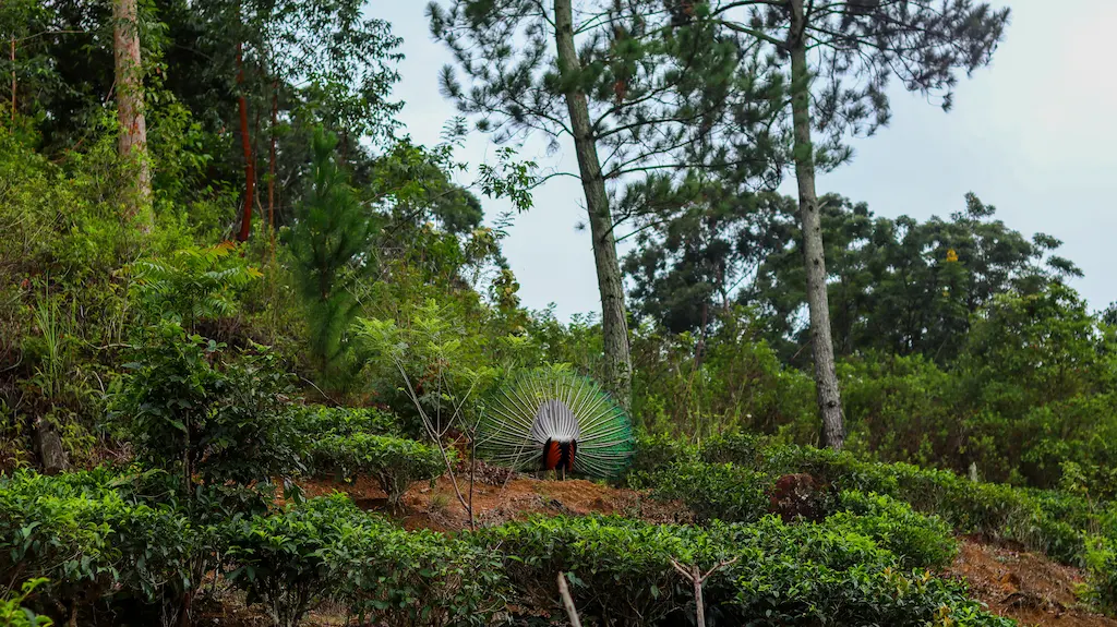
After the monastery, the trail narrows and meanders through tea bushes taller than expected. The forest thins, giving way to rolling plantations, framed by misty peaks. The occasional scent of wet earth and leaf litter fills the air.
Watch your step — the path is rocky and can be slippery when wet. Ale got attacked by a few leeches here despite precautions, so long pants and leech repellent are essentials, especially in the rainy season.
4. Approaching Ella Rock Summit
At around 3 km in, the trail steepens slightly and enters a eucalyptus-pine forest. This section can be foggy and slippery, but it is the last stretch before the summit.
We reached the official Ella Rock Eco Tourism Zone, where you must pay the entry fee.
5. The Summit Experience
Ella Rock’s peak is a rocky outcrop with some small shelter spaces and plenty of friendly mountain dogs to keep you company. Even shrouded in fog, the atmosphere here was magical.
6. Descending via Ella Town Route
The descent follows the traditional steep Ella town path, just on the side of the ticket office, next to the sign. You’ll see many people hiking up and down; it’s the only section, besides the one you came from.
7. Ending in Ella Town
This trail reaches the village near the train tracks, only minutes from the bustling main strip. Celebrate your hike with a bag of crisp Cassava chips or a cold King Coconut from the local stalls.
Gear, Food, and Things We Wish We’d Known
Bring proper trail shoes, not “they look cute in photos” shoes. My recent purchase in Abu Dhabi, a sturdy Puma sneakers with a good sole, has paid off.
I held the grip easily, even in difficult conditions, and aren’t hiking shoes. We saw locals hiking barefoot and some adventurous foreigners in flip-flops, so anything is possible. We still suggest hiking with shoes.
Bug spray is essential. Leech socks if you’re paranoid (we get it now!).
Take cash for the entrance fee and coconuts. Don’t rely on vendors having change for massive bills—this isn’t a day to break a 5,000 LKR note.